We are the Future of Automated
Aerial Intelligence.
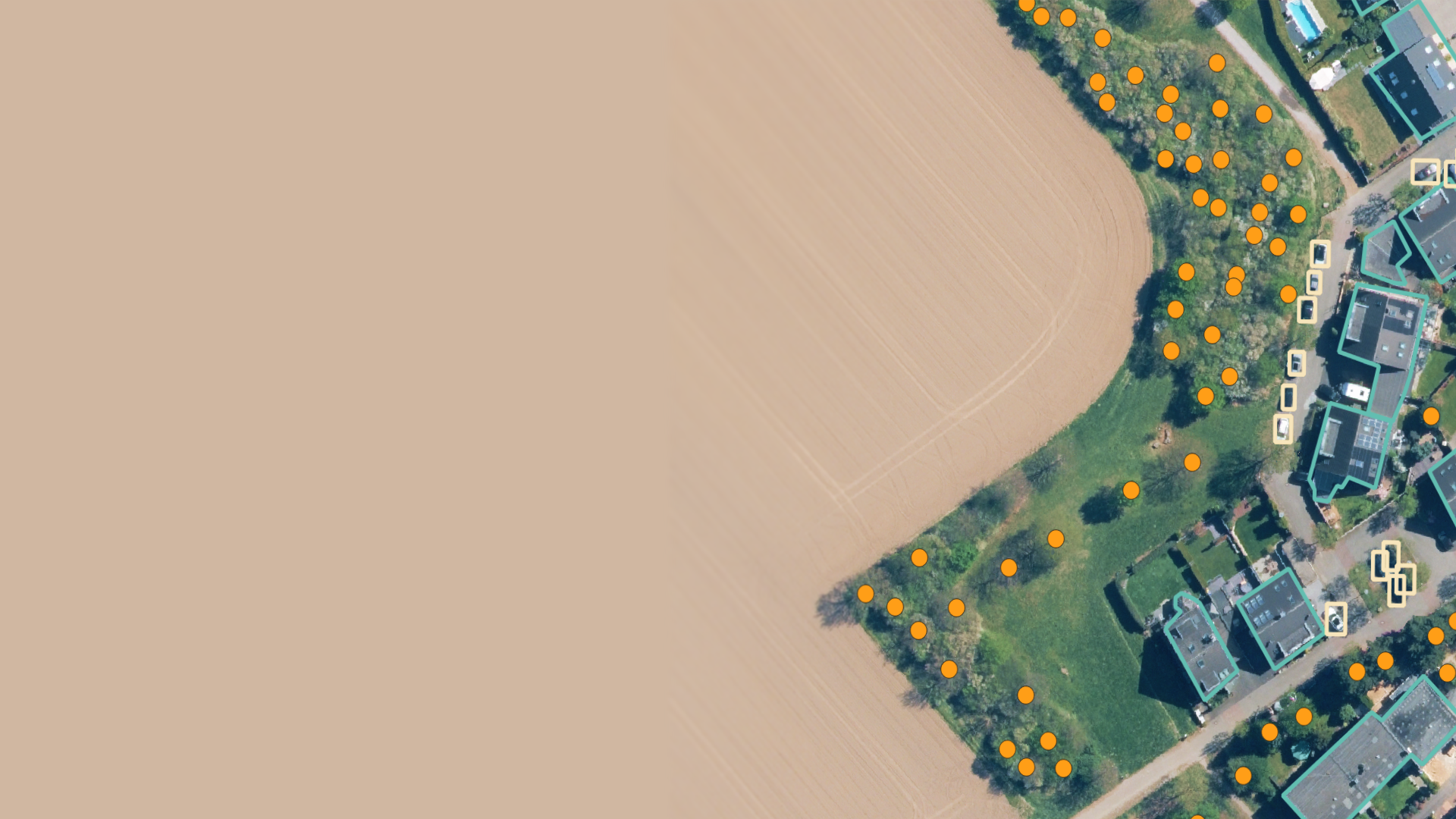
If you can see it. We can count it.
Any object. Any region. Any use case. At Scale
Why Count from Above?

The availability of aerial imagery is growing exponentially.
The next challenge: making sense of it.

Nowadays, many major decisions are tied to location.
With the same location-based problems in one industry not so different from the next.

The Challenge Organizations Face.


At the scale businesses need to operate, aerial imagery from satellites & drones is the most efficient way to get a complete view. But mapping let's say all houses in a city is impossible without automated object detection.
Many organizations still count manually thousands of images by hand, taking up to days to complete. Machine learning (ML) can help turn an image into a map of valuable insights and at scale, but costs excessive development time and expensive teams to do so.
Instead, organizations reinvent the wheel again & again…spending years of expert time and huge costs to build their own ML solutions from scratch.
Every hour spent is an hour too late.
The ability to analyze aerial imagery from satellites, drones and planes has been existing for years. But no one has truly made it accessible to those on the ground just yet.
Our solution changes that.
Our Machine Learning-as-a-Service for building your own industry quality object detection from above with confidence
Made for ML experts anyone, at any skill level.
Any Object Any Region At Scale
At a fraction of the Cost & Time.
We solve the lag in aerial intelligence. By providing a platform that allows on-the-ground teams to build and deploy their own imagery analysis models instantly, we turn satellite, drone, and plane data into reliable, actionable insights. This agility removes dependency on costly development cycles and specialized teams.
Trust the insights you create, instantly.

Join our Waitlist
Ready to transform your aerial imagery into action in minutes?
Connect with us to explore how Count from Above can solve your specific challenges.
Free consultation on your use case
Custom pilot program available
No ML expertise required